


City Vision | Live Smart
Everywhere / Virtual Participation
The Challenge | Live Smart
Evaluate environmental, social, and economic data to design tools and plan blueprints for smart and connected rural and urban settlements.
CITY VISION
No Video Provided
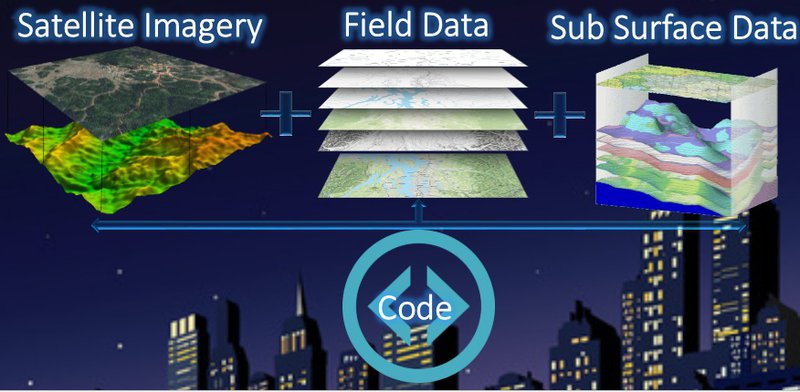
coded all data from satellite, field and subsurface to combine in one single coded map used by anyone around the world and could be easily changed based on the situation around us.
Background: Remote Sensing, Geomatics, Geophysics, Geology, Environmental Science, Renewable energy, Hydrology, Geomorphology.
Challenges: Lack of spatial resolution of some types of satellite data suggested by NASA in resources.
Resources: Aster gdem, VIIRS, Landsat (MSS,5,7,8) from earth explorer - USGS, Landsat NDVI, PPm Rain averages from NOAA, Wind Speed and direction (Radar Data from NOAA, Anemometeric survey, eMODIS NDVI, Field Hydrogeochemistry data and Geophysics, Geotechnical reports.

SpaceApps is a NASA incubator innovation program.