CITY2 | Live Smart
Awards & Nominations
CITY2 has received the following awards and nominations. Way to go!
The Challenge | Live Smart
City2
We believe green is a growth economy and we are introducing green roofs to the world by applying our technology to satellite imagery data.

From left: Alexander, Andreas and Mikkel
Introduction
The City2 project was created at the Space Apps Challenge in Copenhagen, Denmark, and participates in the Live Smart track of the Earth and Us challenge. The team consists of Alexander (Software Developer), Andreas (Service Designer) and Mikkel (Business Developer).
The project aims to address the increasing carbon dioxide levels in metropolitan cities due to the impact of carbon emissions from urbanization. The name City2 reflects the chemical frmula CO2 for carbon dioxide.

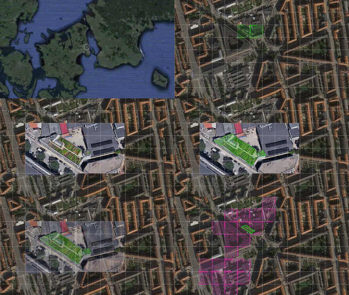
The team has developed an application that applies convolutional neural networks to satellite imagery data for visualizing potential green roof locations in metropolitan cities. Green roofs is a green infrastructure element that enhance biodiversity and helps absorb carbon emissions.
Metropolitan cities
A metropolitan city is an urban area with over 1 million people in population, where the human density is tense and there is a labor market area. Examples of big metropolitan cities are Tokyo in Japan, Shanghai in China and Los Angeles in the United States.
More than half of the world’s population live in urban areas and the proportion is gradually increasing. Urbanization refers to the ways in which society adapts to the change when more and more people begin to live and work in central areas.
There are multiple disciplines that urbanization relates to, such as urban planning and public health. One major concern of metropolitan cities is urban heat islands, which are areas that are significantly warmer than its surrounding rural areas due to human activities.
Green roofs
A green roof is an artificial installment of plant life on the roof of a building and is also referred to as a living room because of its ability to denote reproduction. In the habitat of metropolitan cities, a green roof can provide significant benefits compared to conventional roofs.
The United States Environmental Protection Agency estimates that the
surface temperature of a green roof can be cooler than the air temperature, because
of its ability to remove heat from the air through evapotranspiration. In comparison,
a conventional roof is warmer.
Satellite imagery data
High resolution imagery of urban environments can provide an indication of how much dead space there is on the conventional roofs in metropolitan cities. Satellite imagery data with a low meter resolution can be used to locate urban heat islands.
The global reach of satellite imagery enables an analysis of all metropolitan cities in the world and both the environmental impact of green roofs on carbon emissions and the missed opportunity from existing conventional roofs can be indexed.
Convolutional neural network
A convolutional neural network is made up of neurons, which have learnable weights and biases. It works like an untrained brain, which is taught how to recognize similar patterns. The satellite imagery data of metropolitan cities is processed for green roof location suggestions.

The training set for pattern recognition cover one square kilometer in Copenhagen, Denmark. There is a green roof farm in this area that takes up 1.7 percent and the convolutional neural network found that 19.6 percent is conventional roofs that could be utilized for green roofs.
The proof of concept is available on Heroku and its source code can be accessed on GitHub.
SpaceApps is a NASA incubator innovation program.

