


IAMU Drone | Live Smart
Awards & Nominations
IAMU Drone has received the following awards and nominations. Way to go!
The Challenge | Live Smart
IAMU Drone: Image Analyzing Multi Utility Drone
IAMU Drone, a.k.a Image Analysing Multi Utility Drone is a smart data collecting and image processing drone. With the power of AI, It can take and recognize photos and actually tell you what's actually in those photos!
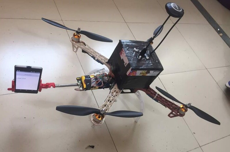
IAMU Drone has capability to take photos and analyse them with the power of AI, so It can be used to do tasks like finding if someone is smoking in a public area, a lot of unexpected crowd in an area, illegal parking or cars in a highway, small fires in a city or even large forest fires, traffic jams, etc. and return all this data to a server so that security controllers can easily operate on the data.
It can even sense various variables like temperature, humidity, PM 2.5 level, air quality and chance of rainfall.
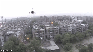
This drone has capability to remotely monitor our planet and notify us about any accidents.
It has automatic flying modes, so the operator can set the coordinates to monitor and automatically it’ll start moving to various coordinates and monitor environmental variables. When it’s battery is low, with automatic power location navigation mode, it itself navigates to the power station from which it had originated when battery level is below 20%.
It has an average flying time of 55 minutes and takes nearly 30 minutes for a full-charge. Apart from this its also water resistant and has acrylic coating on it to prevent it from damages due to water.
During heavy wind, the drone automatically starts landing to the nearest set emergency point.
IAMU Drone can currently lift 4.5 kilograms of weight which makes it suitable for sending medicines to areas where an natural disaster has occurred.
Where all can it actually help us:


Mapping Floods in cities || Survaliance 24/7 for detecting fires

Collection of crowd || Mapping city traffic
These are the potential applications where this technology can be used. No need to dial 911, this technology can provide instant support.
Code: https://github.com/ssarthak598/IAMU-Drone
APIs Used:
- Microsoft Colligative Services
References:
- Setting up Flight Controller: http://www.rndrones.com/arducopter-and-the-apm-26
- http://ardupilot.org/copter/docs/common-apm25-and-...
- APM Intro: https://www.youtube.com/playlist?list=PLYsWjANuAm4...
- Setting up barometer: youtube.com/GUq0hAT9ZgA

SpaceApps is a NASA incubator innovation program.