


Innovative Sustainability Code | Live Smart
Ismailia
The Challenge | Live Smart
Evaluate environmental, social, and economic data to design tools and plan blueprints for smart and connected rural and urban settlements.
INNOVATIVE SUSTAINABILITY CODE
No Video Provided
Usage of Integrated data from Satellite images, Field data, Subsurface data and Geophysical data to create an urban code that could be used in any different localities around the world.
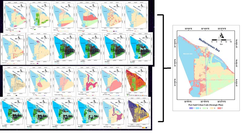
Background: Remote Sensing, Geomatics, Geophysics, Geology, Environmental Science, Renewable energy, Hydrology, Geomorphology.
Challenges: Lack of spatial resolution of some types of satellite data suggested by NASA in resources.
Resources: Aster gdem, VIIRS, Landsat (MSS,5,7,8) from earth explorer - USGS, Landsat NDVI, PPm Rain averages from NOAA, Wind Speed and direction (Radar Data from NOAA, Anemometeric survey, eMODIS NDVI, Field Hydrogeochemistry data and Geophysics, Geotechnical reports.

SpaceApps is a NASA incubator innovation program.