


Below the Wings | Pilots Plus
Huntsville, AL
The Challenge | Pilots Plus
Provide private aircraft pilots and passengers with an easy-to-use tool that gives information about the land underneath their flight plans.
Below the Wings
No Video Provided
Provide information about flight and the terrain below to pilots and passengers.
Project Link: http://belowthewings.herokuapp.com/
Repository: https://github.com/snf2ye/SpaceApps
Features:
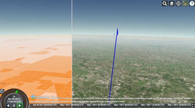
Information about sample flight between Boston and Los Angeles:
- 3D Map of flight route and points of interest along the flight plan
- Selecting airplane on route shows a perspective view from the plane, where the user can explore the terrain below and data of interest overlaid--in this case, population density
Tools and Data Utilized:
- Cesium
- 2012 Population Density Dataset
- Points of interest from NASA's Images of Change

SpaceApps is a NASA incubator innovation program.