FlyGuide | Pilots Plus
Awards & Nominations
FlyGuide has received the following awards and nominations. Way to go!
The Challenge | Pilots Plus
FLYGUIDE
FLYGUIDE is a way to have interesting, interactive and thoughtful plane flight!

We lose so much interesting information during our journey on the plane. We want to solve this problem by our app and prevent you from falling asleep on board at the same time!
How it works
Everyone has a smartphone now, and if you forgot to download music or a film before the flight, frequently it turns into a useless brick on board because there is either no internet connection or it's very expensive with abysmal speed so all services are switched off. But today there are plenty of planes with cameras installed underneath that live-streams to a provided multimedia system, local wi-fi with paid internet access (prices are too high but quality is at a low level). Additionally, you can find a movie library (that can be used as a server) for the onboard multimedia system.

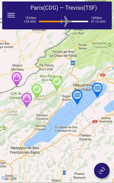
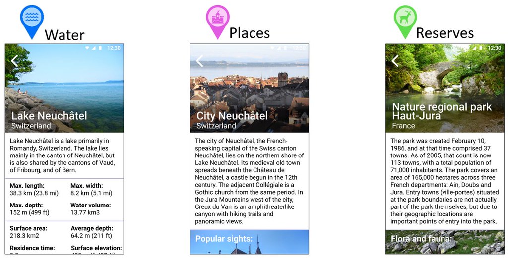
So we combine all those things. You connect your smartphone to the plane’s local wifi network, open our app and you can see the streamed feed from the camera under the plane with marked places of interest, which are stored on the local multimedia server. And for any marker you can get cool facts, colorful pictures, and other interesting information about the place.
How does the mobile phone understand where it needs to place a marker?
It’s very simple. We have the location and flight altitude from the plane’s systems, places’ coordinates from the database on the local server, and feed from the physical camera. By running these things through the stereometrics, we can place markers in the right places.
What about safety?
In our solution, the phone only receives data and does not send anything back. We can block outgoing packets very early, when they have not reached the onboard systems yet, and thus we achieve level of security no worse than at present.
INTERACTIVITY
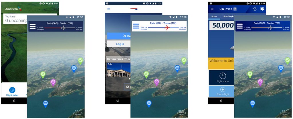
In our app, we do not just show a list of places you are flying above. To learn more about the place you need to click on the appropriate marker. Also, if the plane camera has an ultrawide angle or even a 360 degrees mode, you can rotate your phone and watch a 360 video. It makes the entire flight more enjoyable and provides better orientation in space as your phone direction coincides with the camera position relative to you. You can even have a porthole view on your phone screen!
What if it’s too cloudy or Imissed some markers?
Don't worry! Just switch to the map view mode and you can have the same functionality with satellite pictures.

INTERESTING PLACES
All places would be added by ordinary people! If you know a nice place: a lake, a forest, a town, etc. that has a great view and interesting history and you want to put it on the map, just go to the site, fill the form and wait a little bit.

Moderators will select the most interesting propositions, enrich them with interesting facts and stories or beautiful views and then put them on the map.

Do I need to download something?
NO. It is already integrated into your airline mobile app. Just launch it, find a special section, connect to the onboard wi-fi and you are ready to explore!

business side
All airline companies are very interested in data about users. To get this data, the airline must convince the user to visit the website, call by phone or install the app. So, integration of our solution into their app can boost the download count, which in the long term will allow the company to enhance marketing and increase profit. Also, it can also be an excellent advertising tool. But users will also be happy, as the entire service is absolutely free!
Thank you for reading. We hope that you liked our project and will help us make the flights unforgettable!
RESOURCES USED
App dev:
- Java
- Andoid Studio
Website dev:
- Flask + Python
- uWSGI
Design:
- Scatch
About us
Maksim Diakov - idea creator, backend, website developer, second-year student
Alexander Naumov - designer, second-year student
Djavid Khalilov - mobile app developer, third-year student
Roman Ismagilov - mobile app developer, final-year student
Links
our presentation: https://drive.google.com/file/d/0B1_ParDkvAgdZFV6a...
mobile app: https://github.com/Pomis/FlyGuide
SpaceApps is a NASA incubator innovation program.