


Pink Eagle | Pilots Plus
The Challenge | Pilots Plus
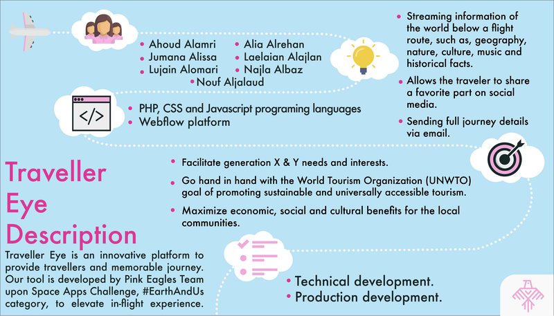
Traveler Eye
Traveller Eye is an innovative platform that provides travellers a memorable flight journey. Our tool is developed by Pink Eagles Team, upon 2017 Space Apps Challenge #EarthAndUs category listed challenges, to elevate in-flight experience.
Traveler Eye Web-based Platform Dummy Demo: www.travellereye.co
Traveler Eye Web-based Platform Initial webpage: https://drive.google.com/file/d/0By9XYePssWsMTWZpM...
How it works
An app-based moving map up-to the minute streaming information of the world below a flight route. Traveler’s route and current location are constantly updated, and triggers related information from our database. A web-based version of Traveler Eye was also developed to be installed on existing in-flight entertainment portals.
World below route information includes: geography, nature, current weather, local time, language, country, flag, currency, capital, food, music, famous places and people, and historical facts. It also allows the traveler to favorite and share a favorite part on social media accounts as well as sending full journey details via email.
Why we need it
- Facilitate generation Y and generation Z needs and interests
- Go hand in hand with the World Tourism Organization (UNWTO) goal of promoting sustainable and universally accessible tourism
- Maximize economic, social and cultural benefits for the local communities
What technology were used
- PHP and Javascript programing languages
- Webflow platform
- iMovie
- Balsamiq Mockups 3
Where do we stand
The team has developed a demonstration of Traveler Eye app and webpage.
What is next
- Technical development: a real-time app and web based, user type customized content (passengers and aircrew), age customized content (kids and adults), window view snapshot feature, save locations on personal google maps account.
- Production development: publish a public app as beta version to attract customers and commercial flights industry.
What resources were utilized:
World Tourism Organization (UN-WTO) website
Fly Over Country app
FlightAware
The Flight Paths Tracker: How to Monitor and Analyse Air Traffic Above Individual Locations
Challenges faced:
Time constraint: coding required more time to connect the real-time location with the database that we built on the spot.
Existing flight tracking tools: accommodating most features of existing flight tracking platforms in addition to our unique features.

SpaceApps is a NASA incubator innovation program.