


WinSAT | Icy Polar Opposites
The Challenge | Icy Polar Opposites
CryoRoute
Naval Vessel Route Optimization in the North Artic
This project was created with regards to the University of Windsor's Space and Aeronautics Team, WinSAT (https://winsat.ca).
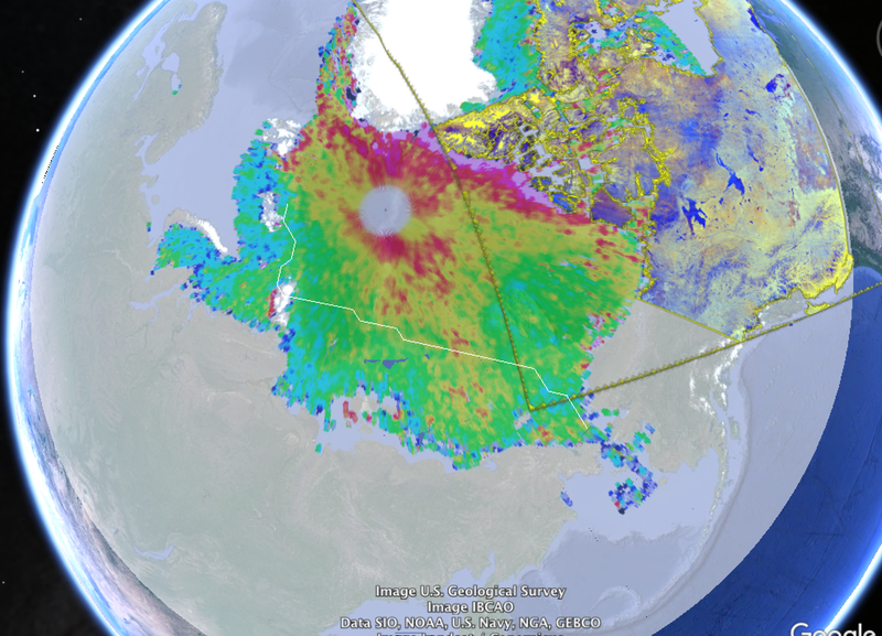
This alpha stage product was developed as a proof of concept and mission objective for out 3U Cube Satellite under development by WinSAT for the Canadian Satellite Design Challenge, CSDC. We took data sets from the CSA Mosaic product from RADARSAT-2 and CPOM's sea ice thickness from CryoSat-2 for a beautiful image of the North Arctic and the Canadian Archipelago region. A custom python algorithm was developed to remove the noise and null space from the Mosaic. We then simulated Naval AIS receivers by simulating a naval vessel's position as well as destination.
A customized version of Dijkstra's algorithm was developed to create a route based on the International Marine Organization's Polar Code for Navel vessel sea ice thickness classifications. This algorithm reduced induced risk and damage to the hull whilst increasing route efficiency (time, fuel) by producing a long duration route.
3 versions of our map was produced on Google Earth, Cesium, and the Google Earth 2.0. Our Alpha version Cesium product can be viewed at https://winsat.ca/cryoroute

SpaceApps is a NASA incubator innovation program.