


Heisenbugs | Water, Water, Everywhere!
The Challenge | Water, Water, Everywhere!
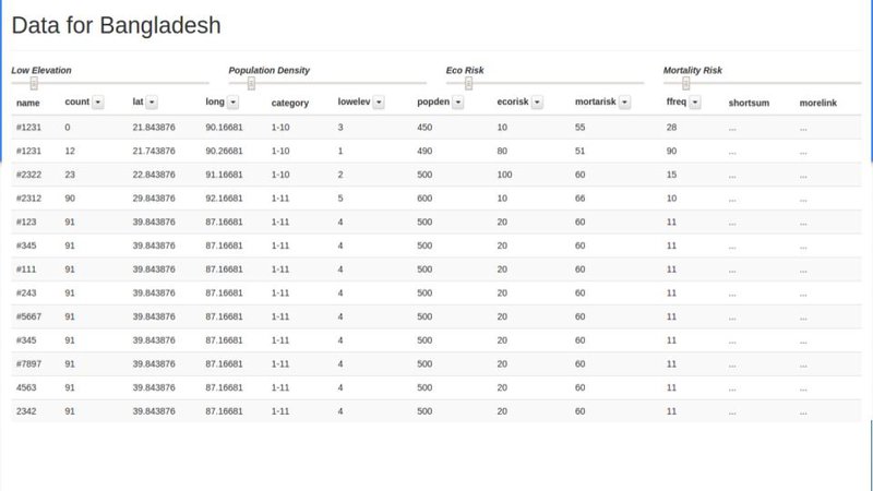
Predicting The Most Dangerous Areas For Flood Disasters Using NASA EarthData
Find areas that will face the most damages in case of flood.
Many areas around the world are affected by flood and other water related disasters due to rise in earths temperature, climate change and many other factors.
Most of these risky areas are in a zone called the 10m Low Elevation Zone.
But there are too many areas in this zone. So non-profit organizations can not help all of them.
We analyse the mortality risk, population density, economic damage, frequency and distribution of flood occurrences and various other data
to find out and categorize the most risky areas in the 10m Low Elevation Zone.
Then we present the results visually and in an easily accessible application,
So that any related authority can easily find out the areas that require their help the most.
Final Presentation Slides
Github (Work in Progress)

SpaceApps is a NASA incubator innovation program.