


Iridium | Water, Water, Everywhere!
The Challenge | Water, Water, Everywhere!
FLOODSBEE
iriduim is a group of amateurs who are touched by the severity of the disasters that our planet is suffering nowadays including floods and water pollution and its effect on the health of people and sea creatures .Here comes Floodsbee, to solve this!
Floodbees is an innovative solution in the domain of disaster anticipation and water quality index monitoring.
In fact, our solution is a submarine converged with a water proof drone that are able to monitor water changes during a flood,collect the data(Ph, mud, water speed ....) as well as water quality in wide seas, lakes as well as rivers.
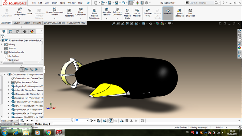
**Submarine:
*the submarine: Contains high quality sensors as a Ph probe , dissolved oxygen in water sensor as well as many other sensors witch are necessary for water quality index calculation.
*the submarine concentrates on the use of renewable energy (solar panels) and are connected to to the internet using a satellite connection. It contains gps to to produce data in each needed geolocation.
*the main purpose of the submarine is the calculation of water quality index and send them to our main database.
**Drone:
*the drone is main purpose is to intervent in case of flood to read flood water parameters(ph, mud ...)
as well as water level variations (caused by either heavy rains of tsunami caused by an earth quake.
*the drone is occupied with high quality probe to calculate flood water flow speed and generate maximum data about the affected area in order to anticipate such devastating disasters.
**Web application:
its main role is to receive detected data and implement our analysis algorithm to extract sensors data in order to provide water quality index as well as flood intensity in each area.(using a map that marks dangerous places .
**android application
its role is to set the itinerary for the drone and the sub marine and to see real time detection values .
it also allow the administrator to set the detection settings.

SpaceApps is a NASA incubator innovation program.