


Maji Maji | Water, Water, Everywhere!
Awards & Nominations
Maji Maji has received the following awards and nominations. Way to go!
The Challenge | Water, Water, Everywhere!
MajiMaji
Floods are a major destructive element that leaves millions of lives stranded all over the world. MajiMaji strives to lessen the blow by providing services that makes surviving the inevitable wrath of mother nature
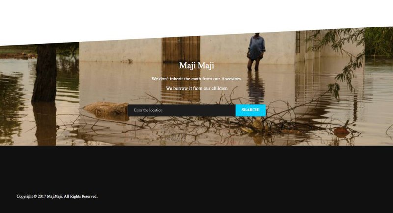
MajiMaji is a web application that aims to save lives by providingcrucial information before flooding occurs;
Bypredicting storm intensity, mapping out the flooding hotspots, thenmap out landing zones, safe routes and relief centers around the area of Budalangi in Western Kenya. This approachhas been discussed below:
- map out flood hotspots
- monitor river buffer zones
- alert immediate users ofimpending danger (flood)
- guide users to safe zones
- map out safe routes
- direct relief services toaffected areas/victims
- map out nearest relief centers
- map out landing spots for airsupport
Conquerthe storm, survive the storm, stay above the water!
-majimaji
ReliefCenters
Weused filtering to find health centers available around Budalangi. Thelevel of health centers were from sub-county level hospitals. Theessence of finding these health centers is that it is a bigpercentage of people would require medical assistance and also act asa safe haven.
BufferZone
Thebuffer mainly describes the area of interest. The river Nzoia isknown to break through its banks and it is the main reason of floodsaround Budalangi area. The buffer zone is therefore an area to bemonitored closely. Maji Maji project has set buffers along riverNzoia a distance of 400 meters on both sides of the river.
EmergencyLanding zones
Thiswas achieved by considering the height above sea level (altitude).The minimum altitude set for safe landing was 1000meters. The contourlines helped us to locate a relatively level ground which is close tothe area of flooding. It is therefore possible to carry out rescuemissions around the regions prone to flooding.
Routes
Thiswas considered so as to let people know which routes are unsafe.Routes were considered unsafe if
- Alongthe way there is an area prone to flooding. It will therefore avoidpeople being trapped in between flooded areas.
- Ifthe routes are below the altitude which has experienced flooding.This can prevent people being exposed to flash floods.
Social Media User Using Twitter API a user takes a photo of the affected area, then tags the location and tweets @__MajiMaji
SMS Push service
Alerts are sent to users who don't have smartphones to access the application. Once the live feed indicates heavy rains in the coming future sms are sent to the users so as to warn them to adequately prepare and also provide them emergency contacts. We used a sms gateway tool service to send alerts to multiple users.
Project Majimaji source: https://github.com/gabrieldwight/Project-Budalangi...
ESRI maps source
Live feed: http://arcg.is/eqeGS
Buffer Zones: http://arcg.is/08WvCy
Relief Centres: http://arcg.is/0uyTOW
Emergency Landing Zones: http://arcg.is/0D8OKy
Paths/ footpaths: http://arcg.is/08WvCy

SpaceApps is a NASA incubator innovation program.