


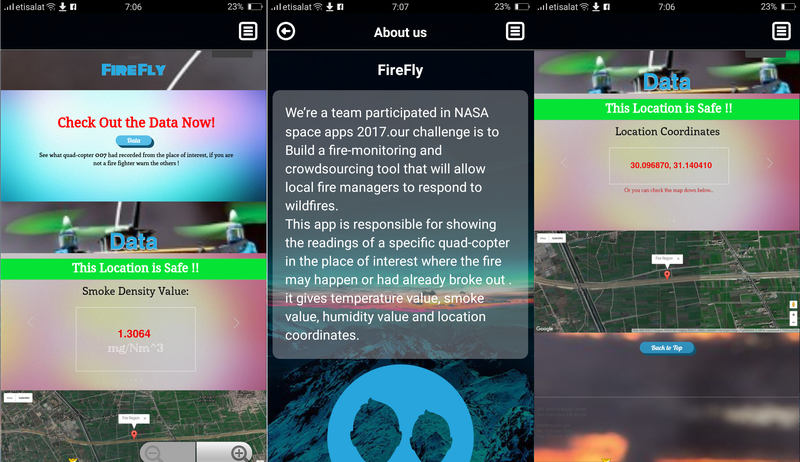
FireFly | And YOU can Help Fight Fires!
Team Updates
Date journey from the satellite to the Firefly data center:
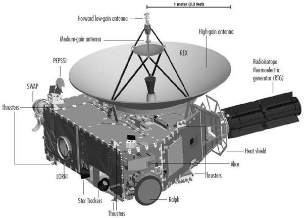
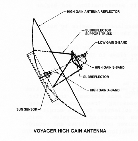
Transmission from satellites is either by a high gain antenna or a low gain antenna. High gain antennas have to be pointed in exactly the right direction, but can send a lot of data very quickly. Low gain antennas don't require precise pointing, but transmit data much more slowly. We chose to work with high gain antennas because we want the signal that a fire has started to be transmitted very quickly so we can manage to launch our quad copter collecting data from fire site, quickly. Based on on the principle we considered through our process (the less humidity and the more temperature, the more probable it's for fire to spread in this direction and vice versa) to identify best paths to evacuate, and guide firefighters to the best paths entering and navigating the area of concert. As we searched about the best relay systems we found what we exactly target in terms of speed and quality, one of the best relay systems is the TDRSS system. This involves several Tracking and Data Relay Satellites (TDRSs) in geostationary orbits around the earth. TDRSS can receive and send data very quickly, at rates from 6 Mbps (mega-bits per second) to 300 Mbps. The TDRS routes that telemetry down to their own set of earth-based antenna and it gets stored in our computers in Firefly date canter, so now we are able to know anytime a fire starts, that it started and where exactly it is, to we direct our quad copter, looking for more accurate data, and some several readings around the starting point of the fire.
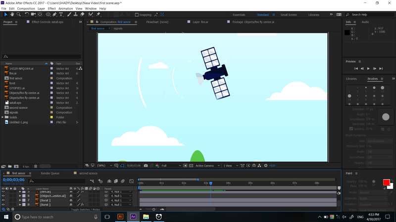
It's time to talk about how the data will be transmitted smoothly from the quad copter to the Firefly data center again to be compared, analyzed and blogged on the colored map showing a detailed map for fire location.
Date journey from the Quad copter to Firefly data-center:
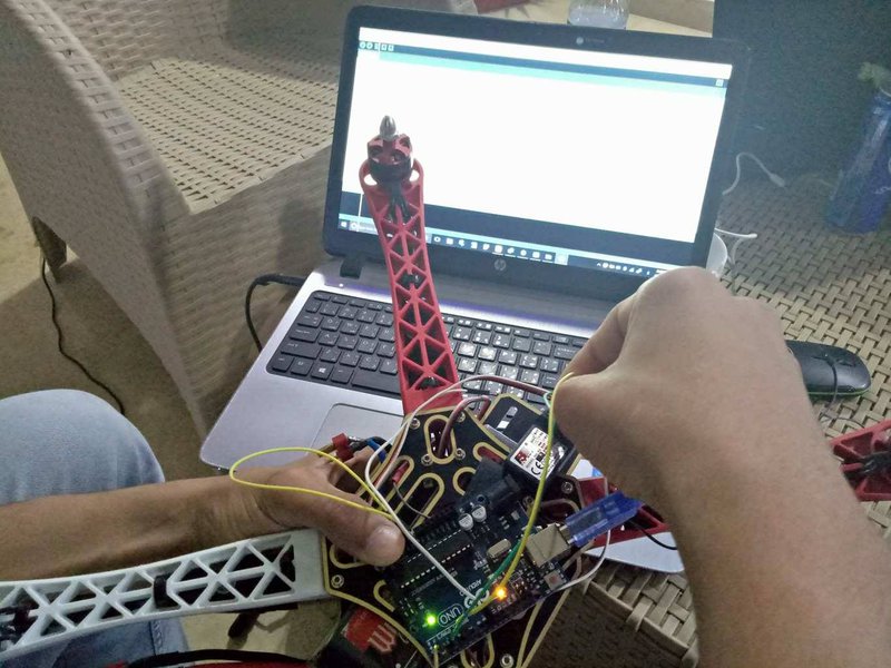
When our quad-copter reaches the fire region, it will collect data by using humidity, temperature and smoke sensors. After that, it will fly to the area surrounding the fire to collect other data from sensors to make it easier for the Firefly data center to determine where the fire might spread or not by comparing these data with the direction of wind and the properties of this place. But how the quad-copter will send these data?!
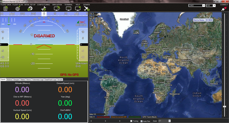
Now, it’s time for the Radio Telemetry 915 MHz (3DR) to perform its role. this Radio telemetry allow our ground station computer to communicate with your quad-copter wirelessly, providing easy way for viewing real time-flight data and changing the mission during the flight.
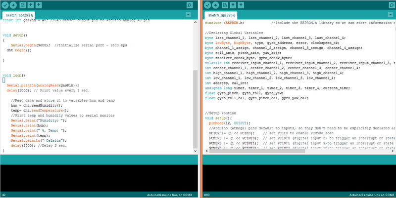
| //Libraries | |
| #include<DHT.h> | |
| //Constants | |
| #defineDHTPIN2// what pin we're connected to | |
| #defineDHTTYPE DHT22 // DHT 22 (AM2302) | |
| DHT dht(DHTPIN, DHTTYPE); //// Initialize DHT sensor for normal 16mhz Arduino | |
| //Variables | |
| int chk; | |
| float hum; //Stores humidity value | |
| float temp; //Stores temperature value | |
| constint gasPin = A0; //GAS sensor output pin to Arduino analog A0 pin | |
| voidsetup() | |
| { | |
| Serial.begin(9600); //Initialize serial port - 9600 bps | |
| dht.begin(); | |
| } | |
| voidloop() | |
| { | |
| Serial.println(analogRead(gasPin)); | |
| delay(1000); // Print value every 1 sec. | |
| //Read data and store it to variables hum and temp | |
| hum = dht.readHumidity(); | |
| temp= dht.readTemperature(); | |
| //Print temp and humidity values to serial monitor | |
| Serial.print("Humidity: "); | |
| Serial.print(hum); | |
| Serial.print(" %, Temp: "); | |
| Serial.print(temp); | |
| Serial.println(" Celsius"); | |
| delay(2000); //Delay 2 sec. | |
| } |

SpaceApps is a NASA incubator innovation program.