


Ignis Fatuus | And YOU can Help Fight Fires!
Awards & Nominations
Ignis Fatuus has received the following awards and nominations. Way to go!
The Challenge | And YOU can Help Fight Fires!
Ignis Fatuus
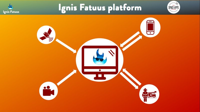
A platform that combines data from satellites, cameras and the crowd to help firefighters identify where a wildfire has started, where it is spreading and the best strategy for minimizing its damages.
Challenge
Build a fire-monitoring and crowdsourcing tool that will allow local fire managers to respond to wildfires.
Problem
Fires are increasing across landscapes throughout the world due to increased drought, increased temperatures, and human-driven changes (e.g., deforestation). When the weather is extreme, the fires are extreme, often spreading beyond countries’ abilities to fight them. Fires can move quickly though landscapes and communities, causing immediate damage and extreme health risks due to smoke pollution.
Often, fires are so big that it is impossible to: (1) see the best paths out; (2) see the best paths available for rescue or fire management vehicles to enter; and (3) estimate where post-fire effects will be the strongest (debris flows, landslides).
Trends
Advanced image analysis techniques, satellites, cameras and drones can automatically detect a wildfire. Furthermore, alerts from people on the ground near areas of concern can be managed by intelligent agents like chatbots. With the power of data science and mathematical optimization models, it's possible to predict how a wildfire spreads around and find the best strategy to minimize damages.
Solution
Introducing Ignis Fatuus, the first platform for Data Driven Fire Fighters.
Ignis Fatuus stands on four main pillars:
1. Image Analysis: we developed an algorithm that is able to detect a wildfire using data from cameras and drones;
2. Crowdsourcing: we developed a chatbot (you can try it here) that is able to manage alerts from people;
3. Wildfire Propagation Modeling: we used algorithms from state-of-the-art scientific literature in order to predict how wildfires propagate;
4. Mathematical Optimization: we developed a heuristic to find efficiently the best strategy to minimize damages of a wildfire, taking into account its expected evolution.
Take a look to our code here.

SpaceApps is a NASA incubator innovation program.