


Ignus | And YOU can Help Fight Fires!
The Challenge | And YOU can Help Fight Fires!
Ignis
Method to find your way to safety when caught in a wildfire
Background:
One of out team members is a Deputy Captain with the Rural Fire Service, and having experienced the destruction caused by wildfires in person, feels very strongly about finding better solutions to the current issues with early warning systems and getting safety information to the people who need it most.
When wildfire strikes, it strikes hardest against those unprepared, who don’t know what to do or where to go. They drive when they would be better served to hide, and they take routes that only lead them into more danger.
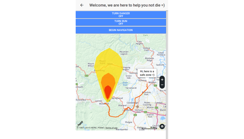
Our Solution:
What we present is an app that will tell them when and where to go. We envisage a notification telling a person that the fire is coming, and so that unlike on Black Saturday they have time to respond. Using data from the Bureau of Meteorology and NASA’s Terra and Aqua satellites, we’ve developed a system that detects fire, predicts where it will go, and gives those who face catastrophe the information they need to survive by mapping a route for them that takes them to safety while keeping them away from any danger areas.
Ignis - gif of program demo
Project page:
https://github.com/NASASpaceAppsIgnus/HowToNotDie
Resources:
- NASA satellites - Near real time data through LANCE of FIRMS from Aqua and Terra
- BOM - Board of Meterology for weather data
- Github to store and share our project
- Trello to keep our project on track
- Canva to create our presentation slides
- Animaker to create a short explanation video of our idea

SpaceApps is a NASA incubator innovation program.