


Run Forrest Run | And YOU can Help Fight Fires!
The Challenge | And YOU can Help Fight Fires!
Run Forest Run
Demo video for the NASA Space Apps Hursley event 2017 for the Run Forest Run team. Project: "And you can help fight fires"
The project description specified that there is a UN target for significantly reducing the number of people who are victims of forest fires by 2030.
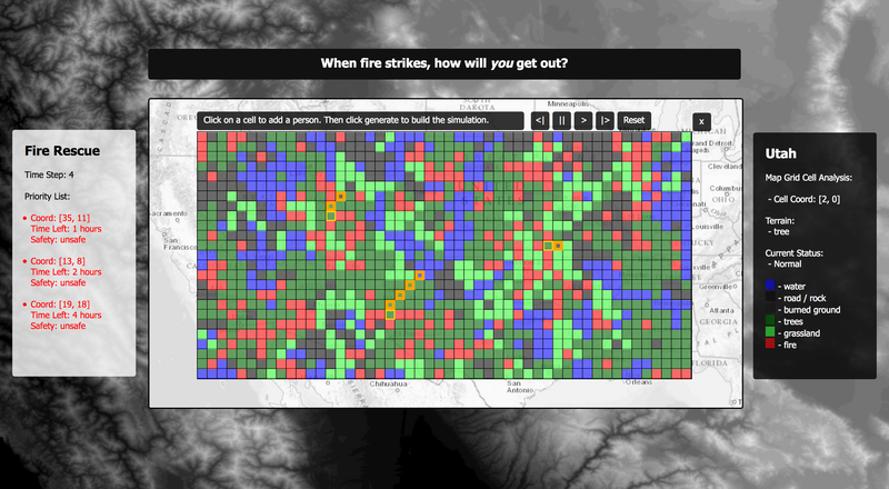
This project focuses on leveraging near real-time satellite imagery to plot and predict the spread of wildfires. Using this information, routes to safety can be predicted for civilians in the area, allowing priorities to be calculated based on their possibility of escape. Using this information, the emergency services can identify who is in the most danger, and prioritise people based on their situation and how long they will be able to survive following our instructions of where to go. They can pull people out of the forest by helicopter if necessary.
Using the VIIRS fire dataset along with geolocation services offered by Google and Weather Underground we identify areas having a high probability of wildfire outbreak. The data is available at different view scales - from street level to town to town to country. With this diversity in the dataset both evacuees and emergency services will be able to have a greater context to help save people and the environment.
We hope this technology can help towards the UN target and save lives.

SpaceApps is a NASA incubator innovation program.