


Los Bólidos | Every Cloud
The Challenge | Every Cloud
MAPP
Mapping of two types of hurricanes v¡by checking their relationship with aerosols
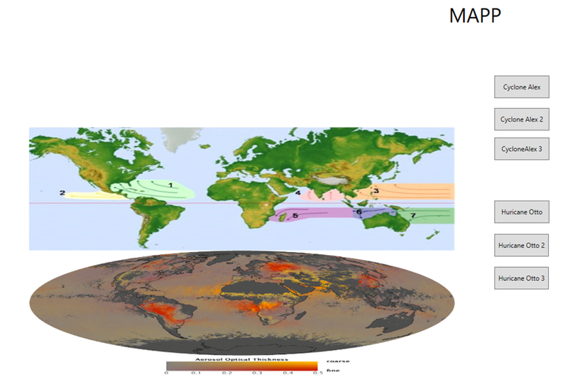
Hurricanes start around 10 and 30 degrees latitude at a depth of 50 meters and a minimum water temperature of 26.5 degrees. This is driven by the action of the north wind current and mixed with aerosols caused by spraying Of sea water with aerosols from the West such as mineral powders, that react with the substances of the spray of the water forming a hurricane of greater size and power and sulphate aerosols from factories or western cities, reacting, again, with the mixture, increasing the violence of the hurricane and its size. Finally, hurricanes maintain their strength and size thanks to the action of hot air and cold air that are intermingled. Due to the Coriolis effect; That initiates the movement of the hurricane; It will always remain in the northern hemisphere and can never go south, just as one in the south can not go north.This is the link of the code of proyect. https://www.dropbox.com/s/pdp8cb7pj6vd4eb/MAPP.rar?dl=0

SpaceApps is a NASA incubator innovation program.