


DPI-Decoder | When Landslides Strike
The Challenge | When Landslides Strike
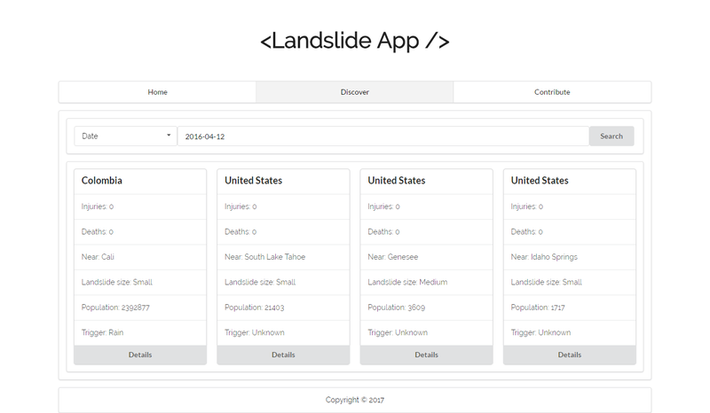
Landslide App
Landslide App helps us to easily discover, understand and contribute landslide data.
People are hungry for knowledge. They are always eager to learn, discover. Maybe they want's to know about natural disasters. Maybe about landslides. There are tons of landslide data on the web. But when they search for data, they get some complicated tools or some API or some JSON/CSV file. Which they cannot understand easily.
Here where our app comes to strike. We built this app to help people easily discover landslide data's by simply searching by any country name, date, landslide size etc. All the data and information are presented in a very easy to understand way. So they easily grab the data, analyze them and do something good.
Resources:
- Javascript ES6 - (For building the application)
- React.js - (Front-end framework)
- More Javascript libraries
- NASA's Landslide data API (For data source)
Challenges:
We built this app in a very reactive way. Once the app is loaded it doesn't reloads pages on change. It just changes the particular part where the data is changed. It is very fast and reliable. It was a great challenge to build this re-activeness. Though React.js helped us to get through this.

SpaceApps is a NASA incubator innovation program.