


Guardians | When Landslides Strike
Team Updates
THE CHALLENGE
Design an easy-to-use tool to allow the public to discover and understand landslide data, and to contribute their own observations for use by emergency managers.
Design a crowdsourcing data collection framework.
You may use fields that are already being used in the GLC.
Ensure that the mobile user interface is easy to use.
Allow for users to contribute multiple field reports on a single occurrence.
Allow for addition of photos.
APPROACH
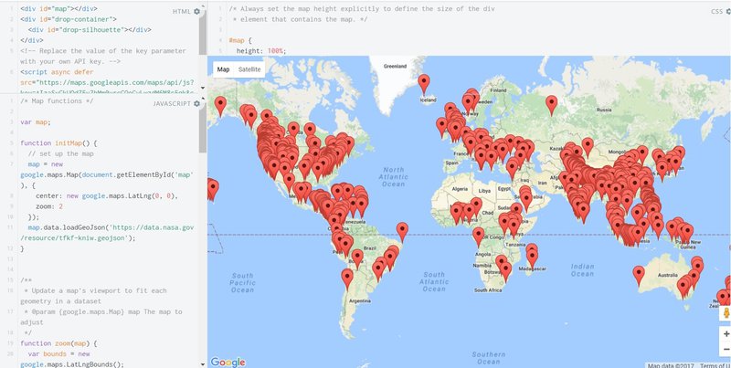
Our aim was to develop a custom user interface to be able to visualize the given historical data overlaid with current data from various sources.
This, however, after working on the prototype we realized that there is a paucity of accessible, dynamic data sets of the predictive attributes (features) of landslide events.
Under ideal conditions, we were hoping to access dynamically updated, structured, the hyperlocal data for selected useful features of: (i) slope, (ii) precipitation, (iii) soil lithography, (iv) elevation, (v) aspect, (vi) glacier outburst & (vii) land cover
Such data is currently only provided on
So we had to change our approach to use whatever is already on hand; ready made platforms, tools & the given data.

SpaceApps is a NASA incubator innovation program.