


Space Bar | When Landslides Strike
Awards & Nominations
Space Bar has received the following awards and nominations. Way to go!
 Best Mission Concept

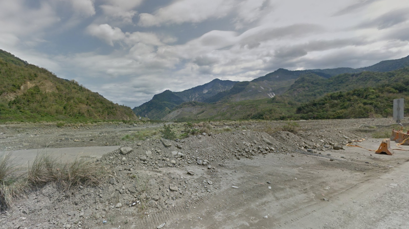
The Challenge | When Landslides Strike
Landslide Victory
Landslide data visualization. submission. prediction.
Use Landslide Victory NOW: http://nasa.nctu.me/
GitHub: https://github.com/Kai-FengChen/LandSlide_BengBengBeng
1. Motivation:
- Throughout the world, it is not uncommon to see human habitation near or among the mountains. People in these areas constantly live under the looming shadow of landslides. The impact of such disasters, be it in the form of death, property loss, or destruction of infrastructure and roads, is indeed devastating.
- NASA Space Apps Challenge shows that NASA has already made public a global landslide monitoring system of its own, providing a wealth of landslide and mudslide records collected worldwide, as well as precipitation data of the week prior to the disaster.
- However, the general public may not be able to read this data effectively. Furthermore, NASA’s data may benefit from merging with local governments’ data.
- Therefore, we strive to build a website that visualizes data from various sources, such as alerts issued, precipitation, and actual landslide measurements. By providing the public with an intuitive report system, rescue teams can obtain crucial updates about the disaster area. This website also raises public awareness of landslides, mudslides, and perhaps even climate change.
2. Introduction:
- Landslide records and monitoring:
These are all layered on a map: observation data from NASA, precipitation records for the week of the disaster, past landslide records, and landslide reports from witnesses (see next point).
- Landslide reports:
Witnesses of a landslide can submit reports and provide real-time updates, allowing rescue teams to identify the exact location of the disaster and enhance the efficiency of rescue missions.
- Landslide public predictions:
Allow the public to wager cash (or other forms of credit) on whether a landslide will occur in a specific location. The experience of these “citizen-experts” may be of great value in making predictions. This idea was inspired by Chicago Mercantile Exchange’s weather futures.
3. Details:
- Landslide records and monitoring:
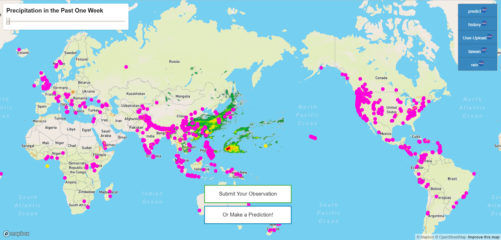
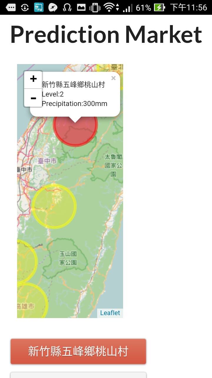
- Use data from “The global Landslide Hazard Assessment for Situational Awareness (LHASA)” model from NASA to mark areas where a landslide is likely to occur based on precipitation data of the past 7 days.
- Precipitation is a significant trigger of landslides. Therefore, the Global Precipitation Measurement from NASA is used to show the accumulated precipitation of the previous days. By pulling the scroll on the page, the user is able to see the changes in precipitation.
- Landslides are likely to strike the same region multiple times because of the vulnerable geological qualities of that specific area. By using historical data from NASA GLC and those made available to the public by local governments, vulnerable areas are marked by dots. By clicking on the dots, the user can see more detailed information and pictures of the landslides in that specific place.
- These information are overlaid onto a Mapbox map. The user can choose to open up just one layer or all layers of the information on the map. This makes NASA data more accessible and comprehensible to the public and highlights the relationship between precipitation and landslides. These historical data help identify where the high-risk areas are.
- Landslide reports:
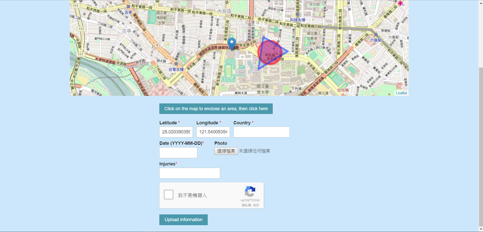
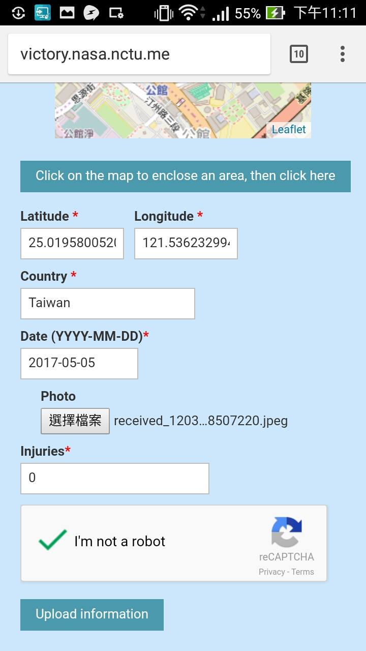
- When NASA satellites detect a change in the topography of a region, the occurrence of a landslide in that area can be easily inferred. However, the rescue teams need more real-time updates in order to carry out efficient rescue missions. The satellite images may not be as detailed as photos taken on site. Therefore, we have incorporated a real-time report function for on-site witnesses/rescue staff to submit first-hand reports.
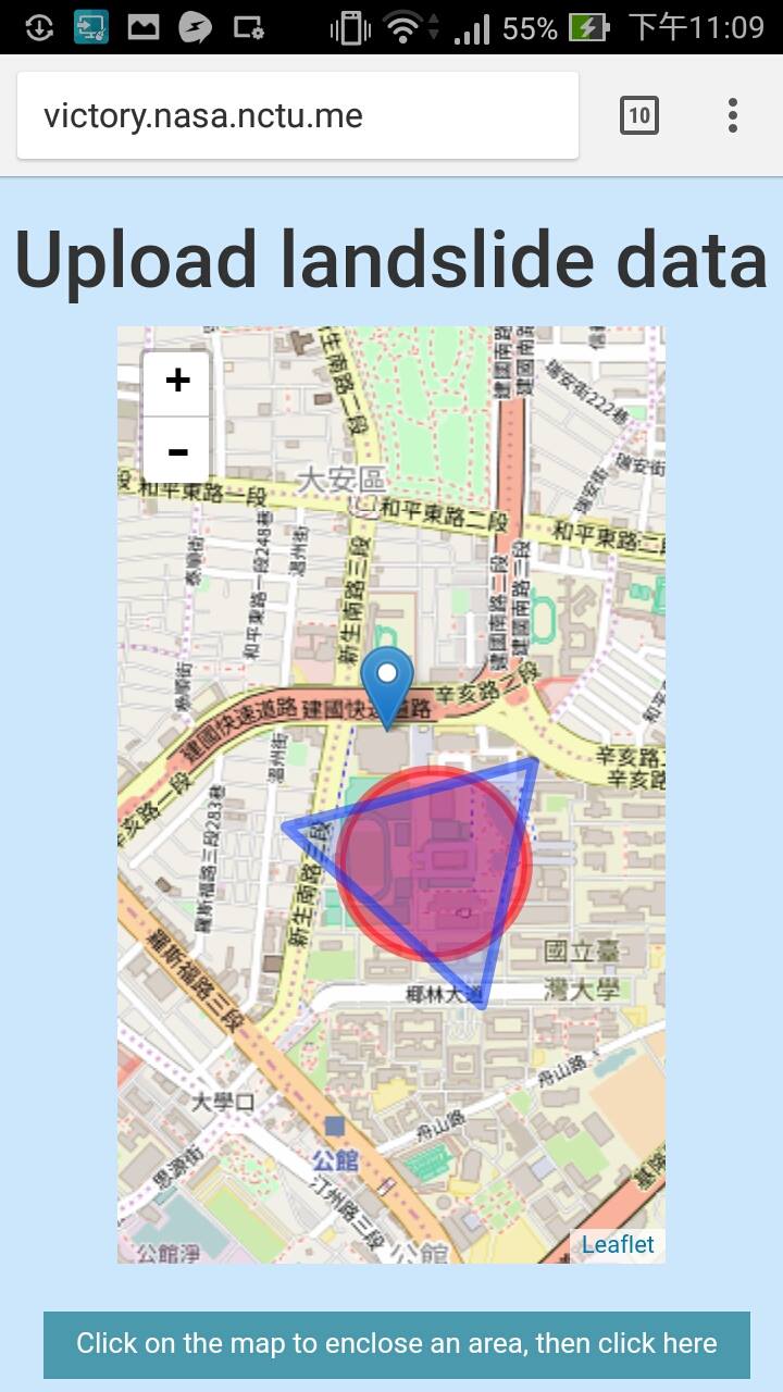
- The witness can mark specific points on the Leaflet map to provide a rough picture of the extent of the landslide. Multiple photos can also be uploaded. The points marked by the witness will be connected to form an area, of which the center will be calculated. This center point will then be the focus of a circle whose size is the same as the original area. The circle will appear on the map for the witness to confirm its location.
- The witness can also submit text in reports. The text will be processed by a form parser before being entered into our database. The website also allows for the upload of photos into the database.
- The report will be added as a JSON file, with the data appearing on Mapbox maps for users to see real-time updates on the disaster.
- To guard against attacks on our website, we use Google’s reCAPTCHA to make sure reports are submitted by actual users, not malicious programs.
- The platform raises public awareness of landslides and makes up for gaps in predictions made by equipment.
- Landslide public predictions:
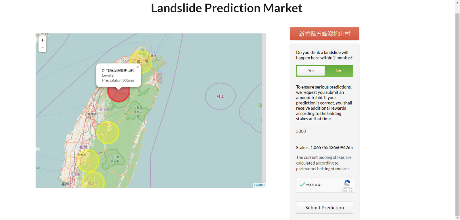
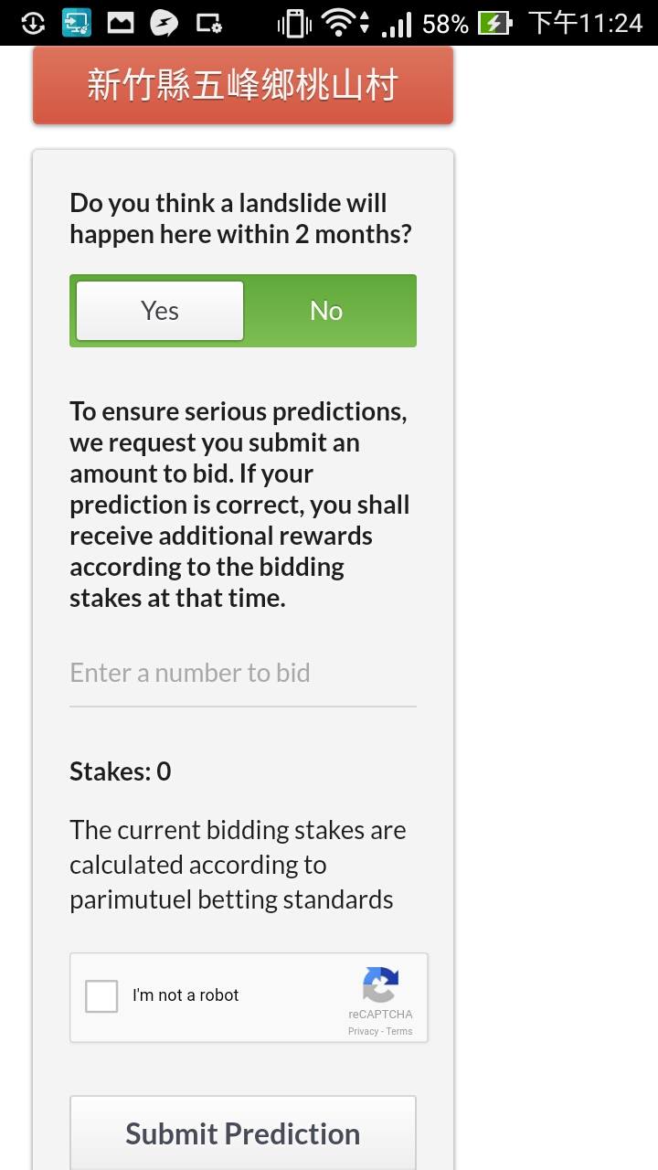
- Landslide predictions are often made based on NASA’s data regarding criteria such as precipitation and topography, as well as on results obtained from machine learning. However, citizen experts may know about other factors that we do not yet take into consideration.
- The website will select a few high-risk areas which citizen experts can bet on. This is based on market information theories which won the 2001 Nobel Prize in Economics. The betting system allows for an honest integration of all information withheld by experts. This has been proven effective in the weather futures market in Chicago, when betting results were more accurate than weather forecasts. Google and Microsoft also use similar tools when making strategical decisions.
- Citizen experts who are confident of their predictions are able to place bets on whether landslides will occur in a specific region. They can bet on “will happen” and “won’t happen.” Experts who have more domain knowledge (and confidence) will choose to bet more, exerting a larger influence on betting stakes. By clicking on “Send”, a bet is made valid and saved, returning a token to be used for redeeming future prizes.
- The betting stakes are calculated by ReactJS at the client side, requiring only a single data request to the backend, decreasing the burden of both server and database.
- The platform can then compare the betting stakes to the predictions made purely based on observation data and identify the difference between the two in order to enhance landslide warning systems.
- Again, we use Google’s reCAPTCHA to guard against programmed attacks on our prediction system.
4. Required Resources:
- Since Landslide Victory is an internet platform, it is compatible with all PC and mobile operating systems.
5. Impact:
- For rescue teams and victims:
The victims and rescue teams may be able to submit real-time reports of the disaster onto the platform in order to ask for adequate relief supplies. This website would also raise the public’s awareness of that specific disaster.
- For the local government
- With historical records and the monitoring page, high-risk areas can be identified. Development plans in those areas can be further assessed accordingly.
- When a landslide occurs, the real-time reports would improve the efficiency of all relief efforts and minimize death and property loss.
- After communicating with the authorities concerned, regulations can be established and implemented to help the government obtain funding for disaster relief.
- For NASA
The open databases provided by various countries will help expand NASA’s own database. The betting system allows for the comparison of citizen betting and landslide prediction systems, which in turn help improve the quality of data prediction.
- For the global community
- The user is able to see landslide occurrences worldwide, and place bets if they wish to do so. This brings more attention to landslides occurring in other countries.
- When a disaster strikes, concerned citizens all over the world can pitch in and help out with disaster relief.
- We provide open source code to all who are interested in predicting and preventing landslides. We also welcome any collaboration opportunities. We hope our solution will raise the public’s awareness on natural disasters and climate change.

SpaceApps is a NASA incubator innovation program.