


Drop the Drought | Our Planet, Our Home
Toronto
Team Updates
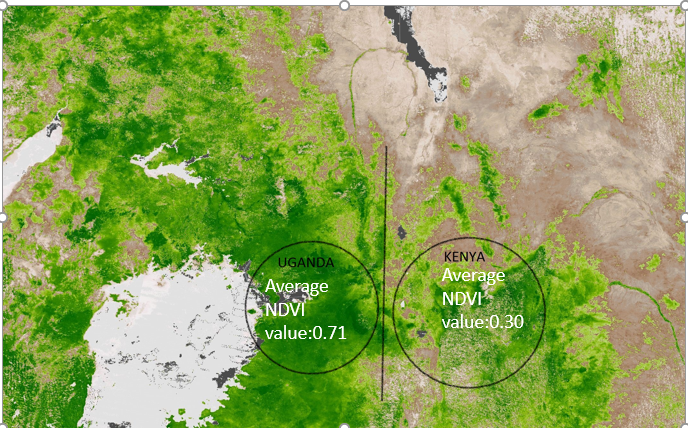
Layer 4: Kenya - Uganda Border Map over laid with Human Settlements Data, Population Density, and NDVI Data (From NASA - SEDAC Centre, United Nations, Landsat and Terra Modis Satellites)
V
Vikas Nath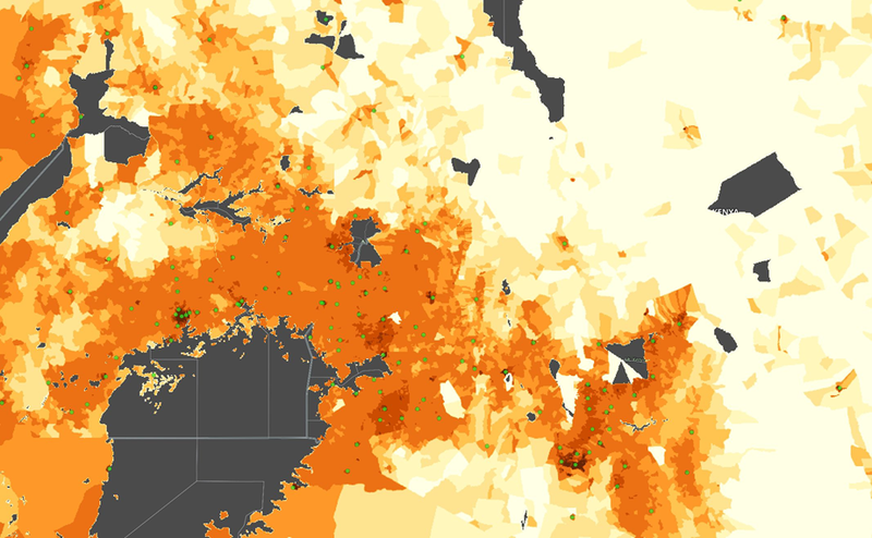
Layer 3: Kenya - Uganda Border Map over laid with Human Settlements Data and Population Density (From NASA - SEDAC Centre and United Nations)
V
Vikas Nath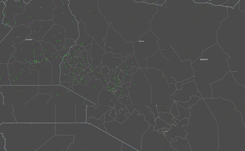
Layer 2: Kenya - Uganda Border Map over laid with Human Settlements Data (From NASA - SEDAC Centre)
V
Vikas Nath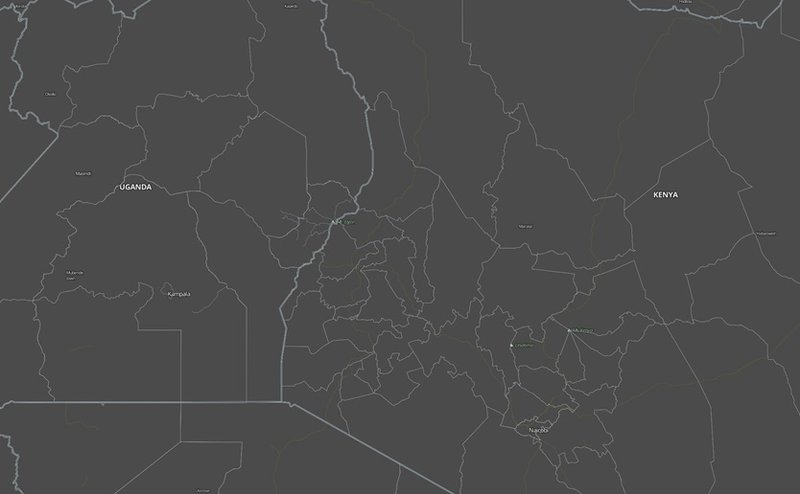
Layer 1 : Kenya - Uganda Border Base Map (used for data simulation)
V
Vikas Nath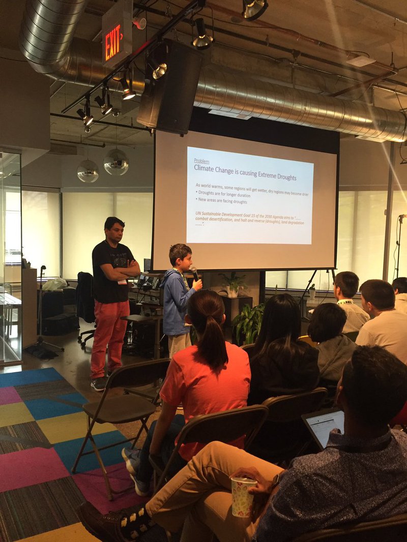
Artash presenting Drop the Drought solution to the judges.
V
Vikas Nath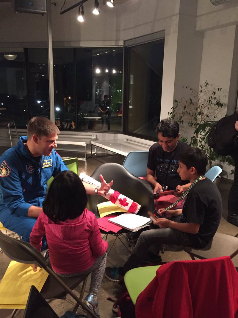
Team discussing with the Canadian Astronaut Jeremy Hansen
V
Vikas Nath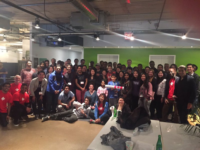
Group Picture of the Space Apps Toronto Participants
V
Vikas Nath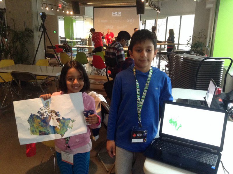
Artash working on his project. It required both printed and digital maps.
V
Vikas Nath
SpaceApps is a NASA incubator innovation program.